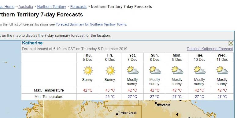
Weather experts are laying the blame for Katherine's heatwave, which kicks off in earnest today, squarely on climate change.
Subscribe now for unlimited access.
$0/
(min cost $0)
or signup to continue reading
Katherine's temperature reached the expected 40 degrees yesterday to launch another seven days of scorching weather.
The Bureau of Meteorology is even tipping our current temperature record of 41.6 degrees will fall over each of the next seven days.
The only overnight change to the forecast of a succession of 42 degree days is a blistering 43 degrees forecast for tomorrow.

No rain is expected and no end of the extreme weather is in sight.
The extreme heat will be a real test for organisers for the many Christmas outdoor events planned for the next week, including the popular carols on Saturday night.
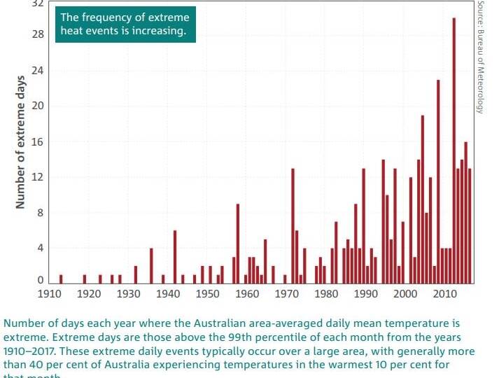
In a tweet discussing the Katherine record, the bureau said climate change "is making extreme heat events more common over Australia".
Katherine already had a record heatwave last month with 16 consecutive days of above 40 degree maximums.
There has been little relief as temperatures fell back to high 30's and the rain continues to stay away.
Rainfall for the first 11 months of 2019 across the Northern Territory was the second lowest on record with only 1961 being drier.
Katherine has recorded 565mm so far this year against the average 1080mm.

The bureau has long forecast a delay to the arrival of monsoons and the wet season until early next year.
No surprisingly, temperatures have also been up in the NT with the second highest maximums behind 2013.
While you're with us, you can now receive updates straight to your inbox each Friday at 6am from the Katherine Times. To make sure you're up to date with all the news, sign up here.


